
Global Positioning System or GPS as it is popularly known is basically a network and collection of satellites that sends signals of their location in space back to earth. These signals are picked up by GPS device holders to determine their exact position down here. It can also calculate the speed and time of an object with a GPS device. The whole concept of GPS started as a necessity at the height of the Cold War to gather sensitive and military intelligence by the USA.
However, GPS usage was opened up to the general population in the 1980s and anybody with a GPS enabled receiver can get its many benefits. Since then, there has been almost unlimited applications of GPS mainly in the transportation sector as trucking fleets, airlines and shipping companies want to know the best routes to get their vehicles from A to B in the shortest possible time.
History of GPS
Even though GPS network was designed and developed by the USA, its inspiration came from the launch of the first Soviet satellite Sputnik in 1957. GPS was conceived to be another weapon for military and intelligence gathering at the height of the Cold War in the 1960s. It is a network of geo-stationery satellites that orbit the planet at fixed points above the earth.
They beam down signals which can be picked up by anybody with a GPS receiver and tracker. These signals have a geographical data point and a time code which enables the user to pinpoint accurately their position, speed of travel and the time present at a specific location.
Even though GPS network was designed and developed by the USA, its inspiration came from the launch of the first Soviet satellite Sputnik in 1957. GPS was conceived to be another weapon for military and intelligence gathering at the height of the Cold War in the 1960s. It is a network of Geo-stationery satellites that orbit the planet at fixed points above the earth.
They beam down signals which can be picked up by anybody with a GPS receiver and tracker. These signals have a geographical data point and a time code which enables the user to pinpoint accurately their position, speed of travel and the time present at a specific location.
The first satellite system that was launched by the USA and tested by the US system was Transit in 1960. There were five satellites in the network and it enabled ships to fix their position on the high seas once every hour.
Updating this preliminary system was carried out at great speed and in 1967 the Timation satellite was launched with highly advanced atomic clocks on board. Between 1978 and 1985, 11 more “Block” satellites were put in space with an aim to strengthen intelligence gathering by the US military.
![]()
In 1983 however, GPS was opened up from purely military to civilian use too. The Reagan administration felt that after the downing of the Korean passenger plane Flight 007 by the USSR, there was a need for aircraft and shipping the world over to fix their positions accurately so that they do not stray into territories of other countries.
This saw large scale innovations and development of GPS Devices for civilian commercial use such as Fleet vehicle GPS tracking devices as well as personal use by trekkers and hikers to chart their courses in the wilderness. In the modern world, GPS devices are used for such diverse functions as earthquake research and climate studies, route finding and geo-caching which is an outdoor treasure hunting game.
Upgrading of the GPS satellite network took a hit with the NASA space shuttle Challenger disaster in 1986 and it was only three years later in 1989 that the Block II satellites were put into orbit. By 1993, the 24th Navstart satellite was launched by the USA, thereby completing the network of 24 satellites which is the overall GPS system the world knows today. At any one time, 21 of these are active with the remaining 3 on standby to provide backup support in case of a failure of one of the 21. The present GPS constellation however has 30 active satellites.
How does GPS work
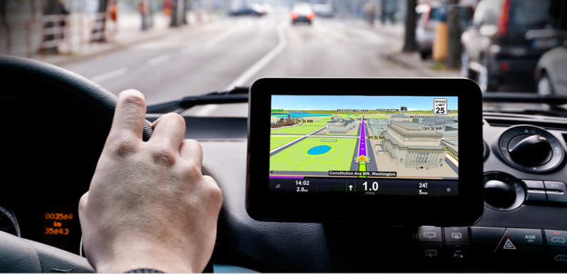
A GPS system comprises of 3 parts. The first is the group of between 24 and 32 solar powered satellites that orbit the earth at an altitude of about 20,000kms. The second is the master control station and four monitoring stations at Kwajalein, Diego Garcia, Hawaii and the Ascension Islands. The last component in the functioning of a GPS network is an expensive feature rich or cheap GPS tracker in a vehicle or any other transporter or carried in person by an individual.
Every satellite is in an orbit in a position that allows a GPS tracker on earth to simultaneously pick up signals from at least four of the operational ones. The microwave signals transmitted by the satellites are picked up by the receiver and processed by the computer in them.
It works out the precise distance from each of the four satellites and then triangulates them to calculate the accurate position down to accuracy of a few meters on earth. In the trilateation process, signals from just three satellites are enough to mark a location instead of the standard four.

The method of measuring the distance from the satellite to the GPS receiver is based on timed signals. An example will help illustrate this point better. Suppose a satellite starts emitting a signal at 14h 45m. When the receiver picks up the signal there will be a time lag in the two as a microwave will take a fraction of a second to travel from the satellite to the receiver. This time difference helps to calculate the distance between the two. The time lag from each of the other three satellites is then computed to pinpoint precisely the GPS tracker’s position on earth.
Applications of GPS
GPS has come a long way from being an intelligence gathering tool in the 1960s to being devices that help in the progress of mankind in various facets of life. It is not simply about finding the best or the shortest distance between two points – it is actually a whole lot more. The basic purpose remains what it started out to be – a location indicator but this aspect has been put to various applications.
Apart from facilitating airplanes and ships and land and surface transport to operate optimally, it can help drivers of land transport get around traffic problems and even use specialised software to receive traffic alerts along the route.

On the personal front, it is a boon for hikers or trekkers who were previously hard pressed to chalk out a route or return to their point of start in uncharted territories. Today, it is possible to easily follow a chosen route and mark out rendezvous points along the way. For emergency services, GPS is extremely useful. It helpers searchers quickly reach the site of an incident especially in rescue operations at sea and in highly inclement weather conditions. In such cases the utility of GPS devices often become the defining factor between life and death.
Scientists too use GPS devices in a wide range of scientific applications and experiments. They can strategically install GPS devices to track climate change as well as monitor geological activity such as earthquakes, earth tremors and other volcanic rumblings. GPS is also used to create very accurate maps of yet to be explored areas in the world.
Advanced GPS systems using state of the art features can send back a host of data to fleet owners once the devices are installed in their trucks. It is now possible to track driving patterns of drivers like a tendency for hard braking and sudden acceleration, fuel mileage and accurate arrival of goods at destination. Any deviation from the designated route will also be immediately notified back to the owner.
GPS can surely be said to be one of the most crucial game changing innovations in the modern world.